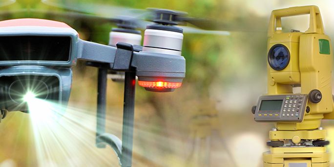
How to choose the right LiDAR for your needs
There are two main types of LiDAR. The first is the airborne type and the second is the terrestrial type.
These two main categories are then divided into 4 sub-categories. Each has its own set of features to meet different needs.
Airborne LiDAR
The airborne type is a laser scanning system attached to an airplane, helicopter or drone. Light pulses are sent to the ground to measure distances and dimensions of the landscape below.
What are the advantages of airborne LiDAR?
– It is easy to scan large areas with no time limit, since data can be collected as long as the plane or equipment is running.
– It saves time and budget because you can cover more area in less time compared to terrestrial LiDAR.
– Compared to terrestrial LiDAR, airborne LiDAR doesn’t have to avoid obstacles on the ground such as trees, power lines, etc.
Types of Airborne LiDAR
There are two types of airborne LiDAR. They both work in the same way, but each has its own set of features.
Topographic Lidar
This type of LiDAR typically maps the land using near-infrared light. The data collected by topographic LiDAR can be used to create topographic maps of the scanned area. It is mainly used for urban planning projects.
Bathymetric Lidar
Bathymetric LiDAR is much better suited for scanning through water. It uses a water-penetrating green laser and infrared light to measure the elevation of the seafloor and riverbed. It can be used to gather information about land and sea, although it is more commonly used for coastal projects.
Terrestrial Lidar
Terrestrial LiDAR is attached to a stationary device or a tripod on the ground.
This system often scans in multiple directions using mirrors instead of scanning down. This allows the system to collect data from all sides. It is used to develop point clouds for mining, archaeology, etc.
Advantages of Terrestrial LiDAR
– Terrestrial LiDAR can work in conjunction with an airborne system to provide more information about an object and a more detailed view of a specific object.
– It is used in areas that airborne LiDAR can’t reach.
Types of Terrestrial LiDAR
Mobile Lidar
Mobile LiDAR systems are attached to moving vehicles such as cars, trains and boats. It is a good option for scanning roads and railways, and it can scan their conditions, signs, and power lines. Mobile LiDAR is often used for 3D mapping because it collects a denser database of points (coordinates). This results in more detailed 3D images and maps.
Static LiDAR
This type of LiDAR is the only one that doesn’t move. It is attached to a stationary tripod and is used to scan the entire environment or to focus on a specific area. It can scan in any direction, including upwards. The tripod can be moved to another location after the scan is complete to ensure comprehensive coverage of the area. Static LiDAR is used to scan building interiors or to scan specific outdoor areas. It is very popular and is used by engineers, architects, archaeologists and mining projects.
VisionLIDAR can create projects from multiple scan types (merge) and process them all.
With VisionLIDAR, you can easily combine data from different scan sources to create a unified and comprehensive project. Our advanced technology allows you to merge scans from different sources, whether it’s terrestrial, mobile or airborne LIDAR, as well as other 3D data collection methods.
Thanks to our powerful processing engine, VisionLIDAR can efficiently manage and analyze all these types of scans. You can:
- Integrate data from multiple scanning platforms.
- Merge and align scans to create a cohesive and accurate view of your project.
- Process large volumes of data quickly and accurately.
- Create detailed 3D models and advanced visualizations.
VisionLIDAR simplifies the management of complex data and provides robust tools to analyze, visualize, and fully exploit your geospatial information. No matter how complex your projects are, VisionLIDAR enables you to complete them with unmatched accuracy and efficiency.
We’d love to hear about your project! Just get in touch.