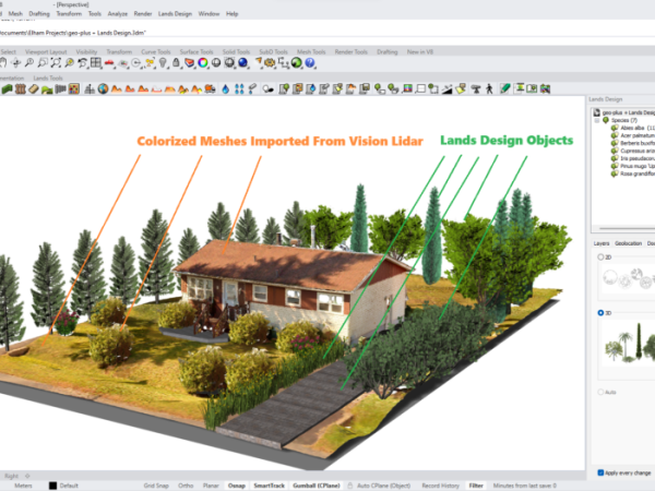
The Future of Landscape Design: Utilizing Lidar Technology
In the fast-paced world of Architecture, Engineering, and Construction (AEC), making informed decisions is paramount to success. Whether allocating resources efficiently or ensuring project accuracy, every choice matters. That’s why we’re excited to…
Keep reading
LiDAR Use Cases Across Various Industries
LiDAR (Light Detection and Ranging) is a pretty amazing remote sensing technology that’s totally changed the way we collect and analyze geospatial data. LiDAR sensors can generate high-resolution, three-dimensional point cloud data that…
Keep reading
Understanding the Types of Deliverables Produced from a Point Cloud
LiDAR (Light Detection and Ranging) is a pretty amazing remote sensing technology that’s totally changed the way we collect and analyze geospatial data. LiDAR sensors can generate high-resolution, three-dimensional point cloud data that…
Keep reading
Understanding the Types of Processes That Can Be Performed on a Point Cloud
LiDAR (Light Detection and Ranging) is a pretty amazing remote sensing technology that’s totally changed the way we collect and analyze geospatial data. LiDAR sensors can generate high-resolution, three-dimensional point cloud data that…
Keep reading
Analyzing Point Cloud Data: Techniques and Applications
LiDAR (Light Detection and Ranging) is a pretty amazing remote sensing technology that’s totally changed the way we collect and analyze geospatial data. LiDAR sensors can generate high-resolution, three-dimensional point cloud data that…
Keep reading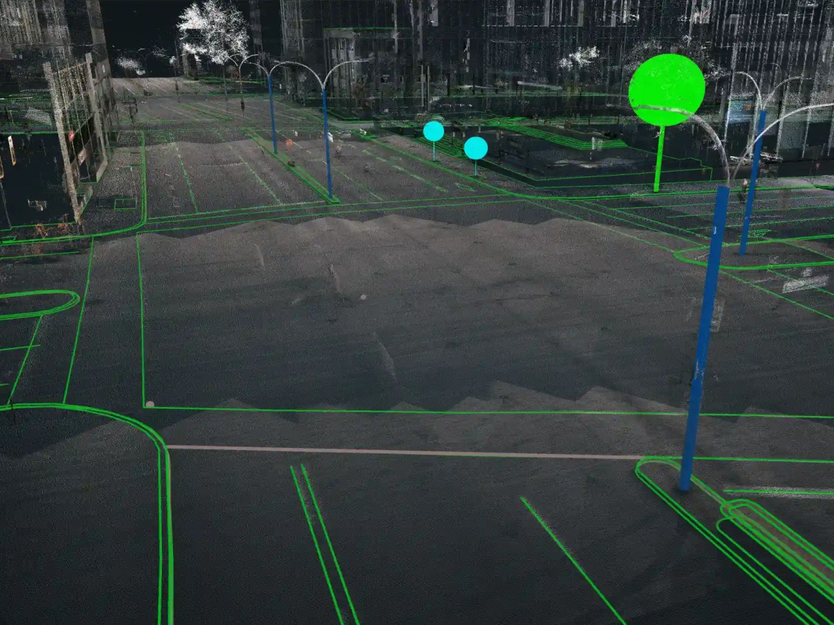
LiDAR Pre-Processing: Tips and Techniques for Data Cleaning
LiDAR (Light Detection and Ranging) is a pretty amazing remote sensing technology that’s totally changed the way we collect and analyze geospatial data. LiDAR sensors can generate high-resolution, three-dimensional point cloud data that…
Keep reading
How to choose the right LiDAR for your needs
LiDAR (Light Detection and Ranging) is a pretty amazing remote sensing technology that’s totally changed the way we collect and analyze geospatial data. LiDAR sensors can generate high-resolution, three-dimensional point cloud data that…
Keep reading
LiDAR or Photogrammetry? Everything you need to know.
While many believe that LiDAR technology only recently appeared,
it was actually created in the 1960s, shortly after the invention of the laser.
Keep reading
The Power and Potential of LiDAR
LiDAR is a 3D mapping technology using lasers. VisionLidar is a software for processing and analyzing LiDAR data in real-time with advanced features for data analysis.
Keep reading
A short story about LiDAR technology
While many believe that LiDAR technology only recently appeared,
it was actually created in the 1960s, shortly after the invention of the laser.
Keep reading
Geomatics… The science of “truth and accuracy”
Geomatics has always been a science of “truth and accuracy” containing a set of geographic techniques. But it has mainly evolved technically and strategically.
Keep reading
One thought on “Blog”
Comments are closed.