
POINT CLOUD PROCESSING SOFTWARE

Architecture, Engineering & Construction

Asset & Facility Management

Energy & Utilities

Infrastructure & Transportation

Land & Resource Management

Mining & Aggregates

Surveying & Mapping

Urban PlanninG | Smart Cities

Digital Twin
LiDAR & POINT CLOUD
VisionLidar Case Studies and Success Stories
Read our success stories
To be successful, we must respond to changing times with innovative ideas. That’s why we have served a diverse range of sectors, including the public sector, construction, and engineering. Companies trust us because we understand the importance of being on time and delivering high-quality results. Explore our VisionLidar case studies and success stories to see how we’ve successfully implemented our solutions across various industries.
Quebec Surveying Industry
LiDAR Technology: The Future of Land Surveying – VisionLidar Success Stories
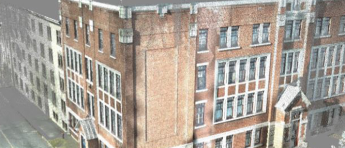
Throughout Quebec, experts are raving about LiDAR, a new revolutionary land surveying technology.. LiDAR, also known as Light Detection and Ranging, allows terrestrial, airborne, or mobile scanning, provides detailed digital terrain models, and records landscapes in 3D. Surveys generate data that can be analyzed in software such as VisionLiDAR.
SNC Lavalin Stavibel
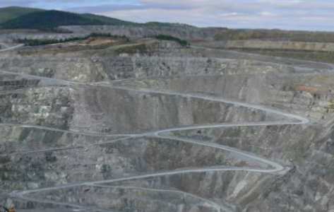
VisionLiDAR to improve safety in Quebec mines – VisionLidar Success Stories
SNC Lavalin Stavibel has been using VisionLiDAR since 2016. Before, the Land Surveying department used to survey using an ordinary total station. Now, thanks to the acquisition of a terrestrial LiDAR scanner as well as VisionLiDAR, Geo-Plus’s Point Cloud processing software, they can detect different surface movements, and focus on their work in mines and other industrial projects.
Jean-François Belzil, former Land Surveyor with the firm, and user of VisionLiDAR, has been quite impressed by all the time he saved thanks to his software. “VisionLiDAR 2017 and its online visualization feature is a big step forward for us. In fact, it facilitates the data and Point Cloud sharing process between us and our clients who don’t necessarily have a software capable of viewing and allowing them to add dimensions and informations directly into the Point Cloud just by using a Web browser.” Mr. Belzil can now use more credible and precise data, as well as offering his services to a larger range of industrial businesses.
“Each month, we have to maintain an update of the data concerning a mine in northern Quebec. Thanks to VisionLiDAR, we can compare reports and analyze the differences between one surface and another,” says Mr. Belzil. The Land Surveyor’s goal has been to improve the security in Quebec’s mines. “By using LiDAR technology, we can now know more precisely if the surface is moving and at what speed it’s moving. Many workers die each year due to a lack of information on soil and mines surfaces. Today, thanks to LiDAR technology, we are hoping to save lives.”
Jean-François Belzil is currently working on registering two Point Clouds to compare the movements in time of a mine’s surface.
Take the first step towards success – build your own success story!
Get the assistance you need in a fly by reaching out to our business development department. They are here to help you with any questions or concerns you may have. Simply contact them to get started.
VisionLidar case studies – as seen on Lidarmag
We are excited to announce that we were recently featured in LIDARMAG! If you want to learn more about our company and the work we do, be sure to check out the article below. We are thrilled to have the opportunity to share our story and hope you enjoy reading it as much as we enjoyed being interviewed for it.
